All aeronautical data provided on this webpage (KML file, OpenAir format, CUP format) are subject to the AIRAC system. This means that data may be amended in a cycle of 28 days which will lead to updates on this webpage. Ad hoc information that is crucial to air traffic operations will be issued as NOTAM.
Sources:
http://eaip.austrocontrol.at/
http://www.ris.bka.gv.at/Bundesrecht/
(Hint: Search for "LVR 2014")
Complaints and suggestions please email to:
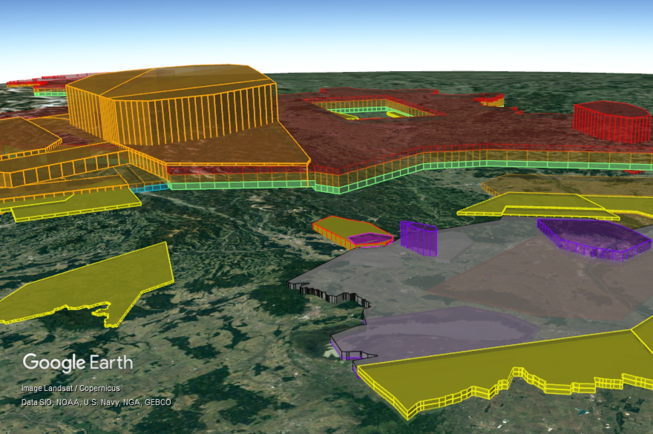
KML Airspace Structure
Digital information on the Austrian Airspace Structure is provided via a KML file. To view the KML file correctly, Google Earth must be installed.
Content of the KML file:
- Civil airspaces
- Military airspaces
- Aerial sporting areas
- ATC Surveillance Minimum Altitudes
- Airports
- Navaids
- VFR Reporting Points
Disclaimer:
The use of the KML files provided here is an additional service by Austro Control and does not relieve pilots from their obligation of pre-flight planning. In particular, use of the KML files does not relieve the pilot from the responsibility to observe the current edition of the AIP Austria, AIP Supplements, NOTAM and AICs. It shall be used for informational purposes only in addition to the official aeronautical publications.
The KML files provided here were created carefully and to the best of our knowledge. However, Austro Control assumes no liability for the previous, actual or future correctness, completeness, functionality or usability of the KML files. The use of the KML files takes place at the user’s own risk. There exists no obligation for Austro Control to continuously update or maintain the data contained in the KML files.
Commercial use of the KML files provided here and/or data contained therein is only allowed with authorization from Austro Control.
KML Airspace Structure
| Title / Subject | Effective from | Version |
|---|---|---|
| KML File Airspaces Austria | 2025-10-3030.10.2025 | 2.0, October 2025 |
| KML File Airspaces Austria | 2025-11-2727.11.2025 | 1.0, November 2025 |
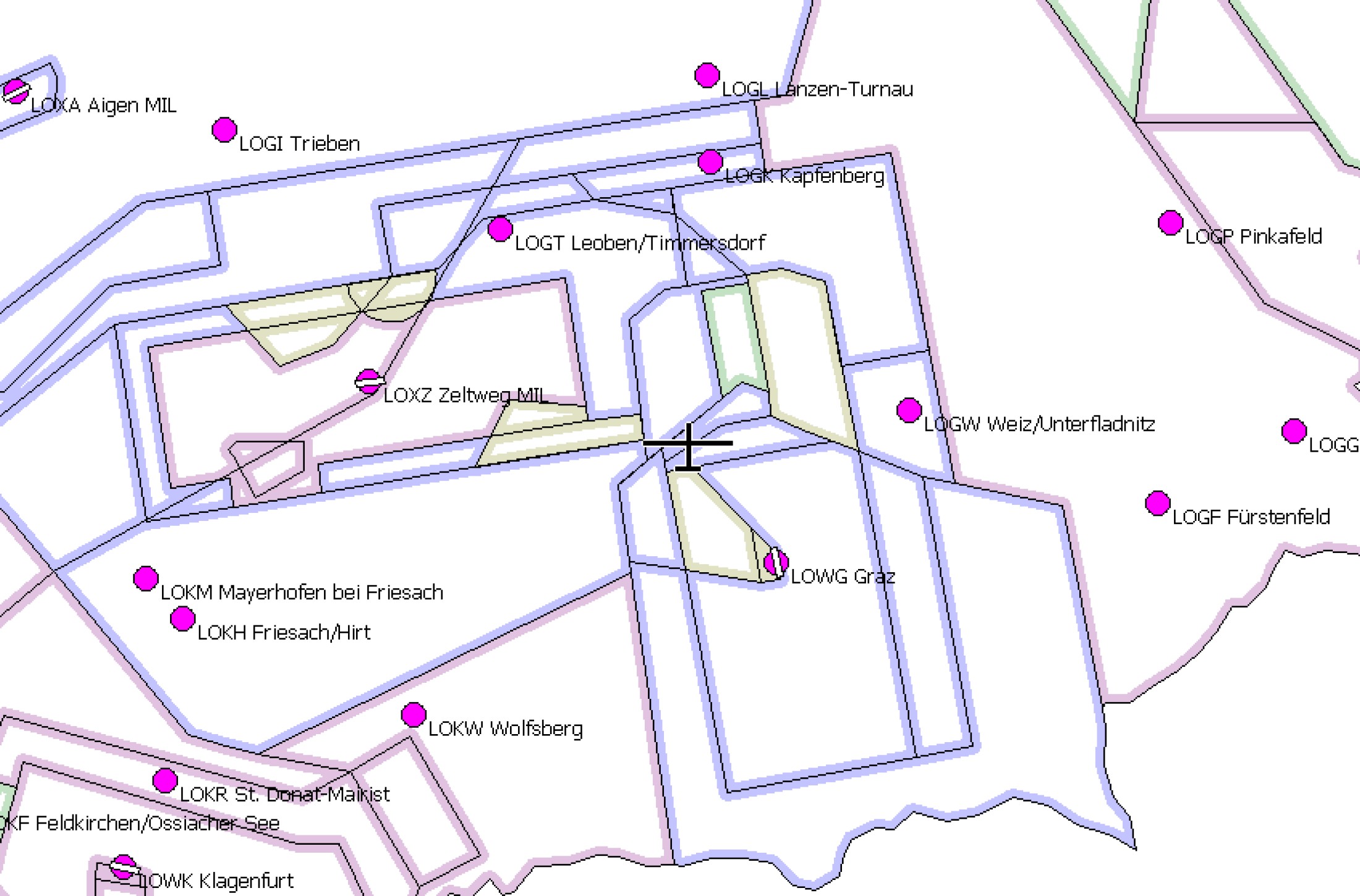
OpenAir Airspace Structure
AIM provides the Austrian Airspace Structure in OpenAir format. To view the OpenAir files you need a special software. For each effective date, three versions of the OpenAir format are provided, which have been specially adapted to the requirements of common software products (SeeYou, XCSoar). In addition to each of the three versions, there is a separate file including the Austrian Military Training Areas (MTAs).
Disclaimer:
The use of the OpenAir files provided here is an additional service by Austro Control and does not relieve pilots from their obligation of pre-flight planning. In particular, use of the OpenAir files does not relieve the pilot from the responsibility to observe the current edition of the AIP Austria, AIP Supplements, NOTAM and AICs. It shall be used for informational purposes only in addition to the official aeronautical publications.
The OpenAir files provided here were created carefully and to the best of our knowledge. However, Austro Control assumes no liability for the previous, actual or future correctness, completeness, functionality or usability of the OpenAir files. The use of the OpenAir files takes place at the user’s own risk. There exists no obligation for Austro Control to continuously update or maintain the data contained in the OpenAir files.
Commercial use of the OpenAir files provided here and/or data contained therein is only allowed with authorization from Austro Control.
OpenAir Airspace Structure
| Title / Subject | Effective from | Version |
|---|---|---|
| OpenAir file Airspaces Austria | 2025-10-0202.10.2025 | 1.0, October 2025 |
| OpenAir file Airspaces Austria | 2025-11-2727.11.2025 | 1.0, November 2025 |
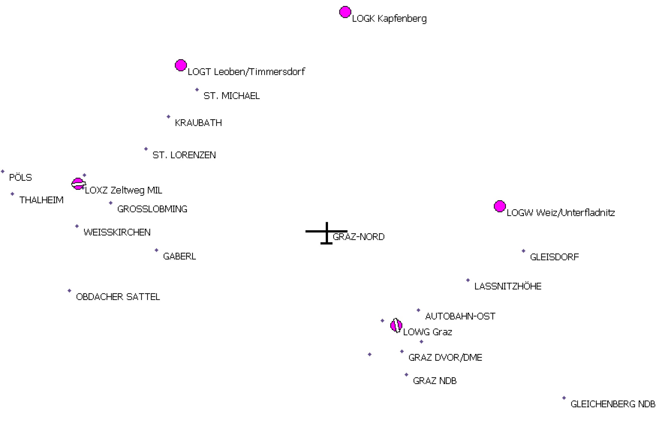
CUP Waypoint list
In addition to the OpenAir format, AIM provides the Austrian Waypoints in CUP format. To view the CUP file you need a special software.
Disclaimer:
The use of the CUP files provided here is an additional service by Austro Control and does not relieve pilots from their obligation of pre-flight planning. In particular, use of the CUP files does not relieve the pilot from the responsibility to observe the current edition of the AIP Austria, AIP Supplements, NOTAM and AICs. It shall be used for informational purposes only in addition to the official aeronautical publications.
The CUP files provided here were created carefully and to the best of our knowledge. However, Austro Control assumes no liability for the previous, actual or future correctness, completeness, functionality or usability of the CUP files. The use of the CUP files takes place at the user’s own risk. There exists no obligation for Austro Control to continuously update or maintain the data contained in the CUP files.
Commercial use of the CUP files provided here and/or data contained therein is only allowed with authorization from Austro Control.
CUP Waypoint list
| Title / Subject | Effective from | Version |
|---|---|---|
| CUP Waypoints Austria | 2025-06-1212.06.2025 | 1.0, June 2025 |
| CUP Waypoints Austria | 2025-11-2727.11.2025 | 1.0, November 2025 |
Poster of the Airspace Structure
The following link provides a scheme of the revised Austrian Airspace Structure in poster format.
Altitude/height information shown in the schematic diagram does not represent actual airspace areas, but shows schematically airspace structures laid down in the Austrian Rules of the Air (Verordnung Luftverkehrsregeln, LVR 2014)
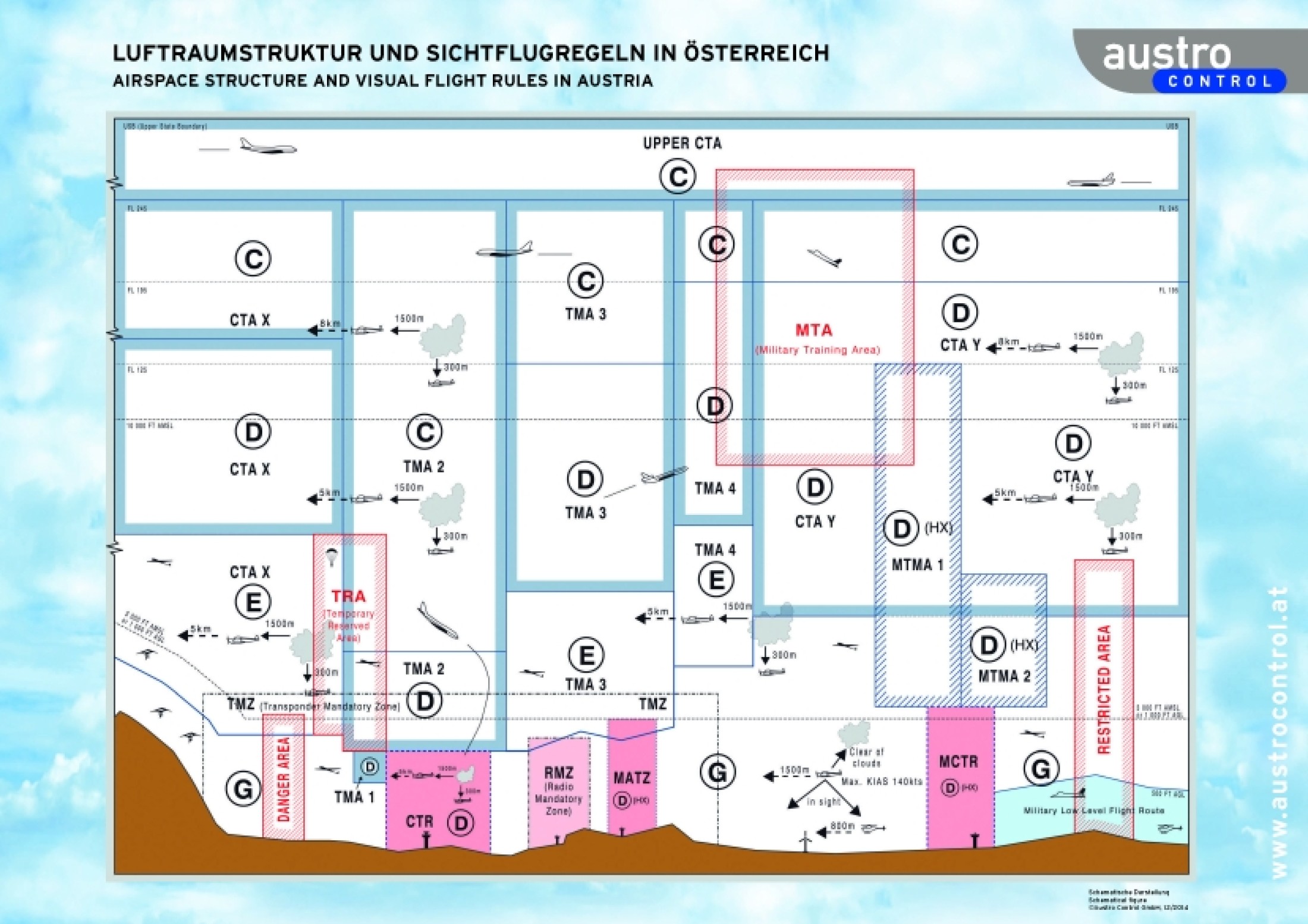
Poster Airspace Structure
| Title / Subject | Effective from | Version |
|---|---|---|
| Poster of the Austrian Airspace Structure | December 2014 | 1.0 |