Interactive Online Chart VFR Austria

The „Online Chart VFR Austria“ is a web mapping service by Austro Control integrated in the web browser, that contains extensive geo-related aeronautical information within Austria relevant to General Aviation.


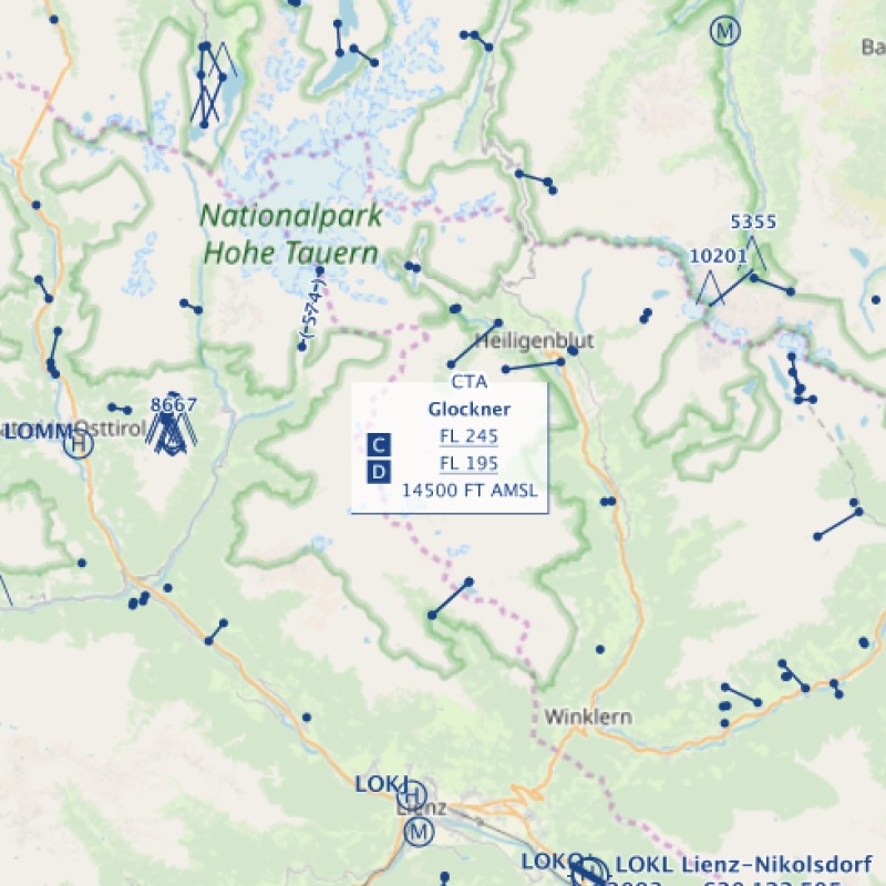
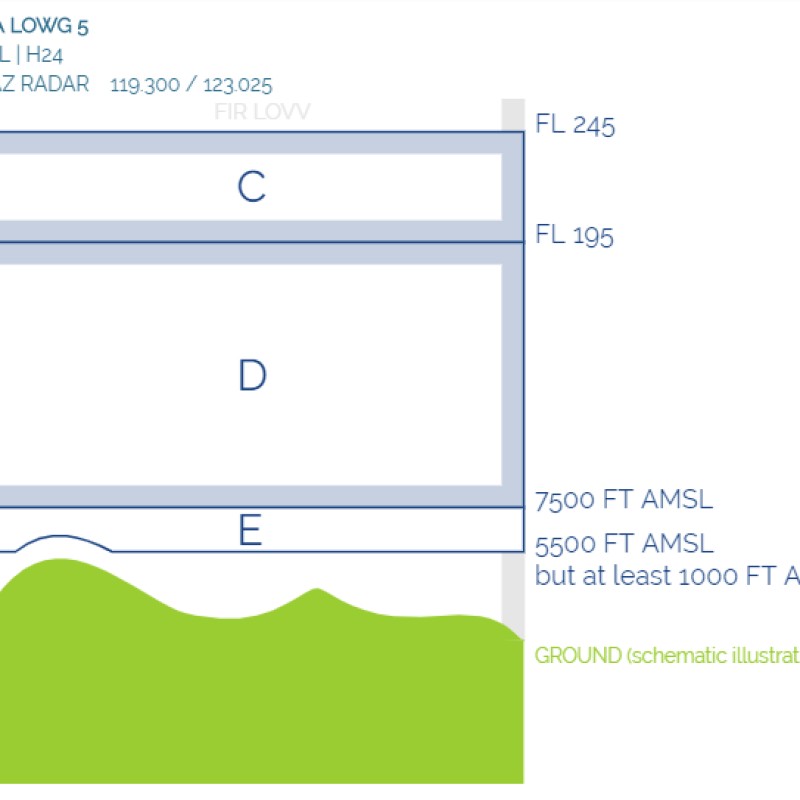
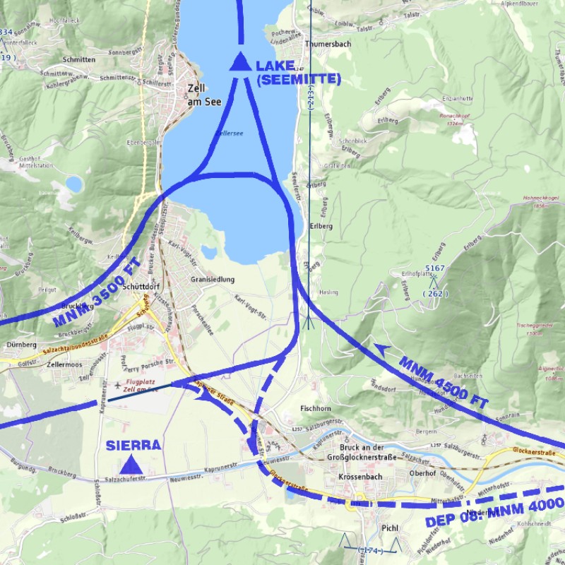
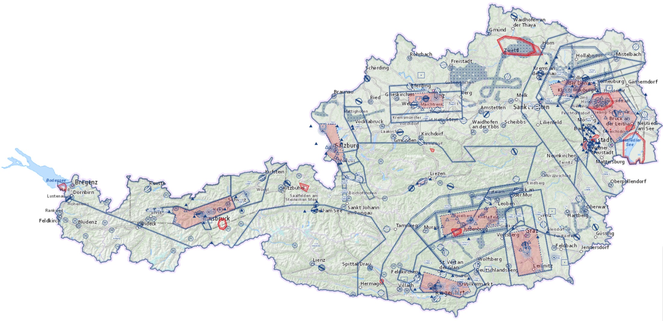
The new online chart is basically comprised of information that is depicted in the Aeronautical Chart ICAO – 1: 500.000 within Austria. In addition, amongst others, areas for aerial sporting and recreational activities, temporary restricted areas, altimeter setting areas, model airfields, all obstacles published in the AIP Austria as well as georeferenced procedures for VFR flights for specific aerodromes can be visualized.
Interactivity within the online chart allows the user to individually compile the map content (by explicitly showing or hiding specific aeronautical information), to flexibly change the map scale (e.g. by using the mouse wheel), to digitize userdefined graphical objects (symbols, polylines, polygons, texts), which can be saved and reloaded at a later point in time, to export aeronautical data, to import KML-, KMZ- and GPX files as well as to measure within the map (also in nautical miles).

The „Online Chart VFR Austria“ always reflects current aeronautical information and is based on the operational state of the valid amendments and AIRAC amendments of the AIP Austria including selected temporary aeronautical information (e.g. temporary restricted areas).
 

The weblink maps.austrocontrol.at will take you to the Online Chart VFR Austria

To start the chart application, first click on „Continue to the Application“ and then select Online Chart VFR Austria. To avoid rendering problems, it is recommended to clear the browser cache from time to time (keyboard shortcut: Ctrl+Shift+Del). Information about technical maintenance, software and data updates and new online charts can be found in the section „History“. 
 
:
:
:
Map projection:
WGS 84 / Pseudo-Mercator (see also: https://epsg.io/3857 and https://en.wikipedia.org/wiki/Web_Mercator_projection)

Recommended web browsers:
Mozilla Firefox, Google Chrome, Microsoft Edge

Disclaimer:
The use of the online chart shown here is an additional service by Austro Control and does not relieve pilots from their obligation of pre-flight planning. In particular, use of the online chart does not relieve the pilot from the responsibility to observe the current edition of the AIP Austria, AIP Supplements, NOTAM and AICs. It shall be used for informational purposes only in addition to the official aeronautical publications.
The online chart shown here was created carefully and to the best of our knowledge. However, Austro Control assumes no liability for the pervious, current or future correctness and completeness for those data depicted this online chart, that are not published in the AIP Austria or in the form of AIP Supplements.
Commercial use of the online chart shown here and/or data contained therein is only allowed with authorization from Austro Control.


Demo video:
On YouTube

Sources:
http://eaip.austrocontrol.at/
https://www.austrocontrol.at/en/pilots/pre-flight_preparation/aim_products/aip_sup
https://www.austrocontrol.at/pilots/pre-flight_preparation/aim_products/aeronautical_chart_-_icao_1500_000
https://www.austrocontrol.at/en/aviation_agency/forms__serviceinfo/general_information/model_airfields
https://basemap.at/
https://www.openstreetmap.org
https://www.zamg.ac.at/

Complaints and suggestions please email to:
: